Umbria’s most technical mountain bike trails wind tightly through beech forests, over uneven terrain where roots and rocks follow one another all the way downhill. This is very different from the compact gravel of white roads: these are true single tracks, the kind that demand your attention at every turn.
Anyone looking for technical mountain biking in Umbria, with steep climbs and demanding descents, will find it on three mountains that few people outside the region still associate with fat-tire riding: Monte Cucco, Monte Subasio above Assisi, and the Umbrian side of the Sibillini Mountains.
These Apennine peaks feature significant elevation gains and officially classified trails. It is worth getting to know them one by one, with distances and technical difficulty levels clearly in mind, so you know exactly what to expect before loading your bike into the car.
Three mountains, one shared vocation
Umbria protects a significant portion of its territory: seven regional parks plus the Umbrian section of the Sibillini Mountains National Park, together covering around 7.5% of the region, according to the Regione Umbria.
These areas are crossed by a dense network of trails, mule tracks and forest roads that provide the perfect terrain for mountain biking.
Each of the three mountains has its own personality: Subasio is the most accessible and closest to services, Cucco is the most technical and vertical, while the Sibillini are the highest and wildest.
And yet these routes are still relatively little known. Search online and you will mostly find generic lists, rarely detailed descriptions including elevation gains and difficulty ratings. For an experienced rider, the first step is therefore understanding how to read a trail’s technical difficulty.
How to read MTB trail difficulty ratings
Before choosing a route, it is important to understand its technical classification.
The Italian Alpine Club, CAI, has established an official five-level scale for mountain biking and cycle touring, described in its dedicated document:
TC – tourist level, on compact and vehicle-accessible surfaces
MC – average technical ability, on mildly uneven dirt roads or tracks
BC – good technical ability, on very uneven dirt roads and mule tracks with some obstacles
OC – excellent technical ability, on highly irregular terrain
EC – the highest level, involving steps and obstacles in continuous succession
The rating is written by separating the uphill and downhill classifications with a slash, since the same trail may be rideable in one direction and highly technical in the other.
Keeping these five levels in mind prevents you from ending up on an OC trail when you thought you had chosen an MC. On the Sibillini or Monte Cucco, that difference can completely change your day.
Monte Subasio: mountain biking on Assisi’s mountain
Monte Subasio, the mountain overlooking Assisi, is Umbria’s best-documented MTB area and a natural gateway for anyone visiting the region for the first time.
The regional park covers 7,186 hectares and reaches an altitude of 1,290 metres. Its regulations are clear about where cycling is permitted: bicycles may only be used on trails, forestry and pastoral roads, and ordinary roads, as established by the Park Plan.
In practice, this means following a recognised network of routes and staying on the designated tracks.
The Park Authority publishes a list of official cycling itineraries graded by difficulty, ranging from the easy route to the Eremo delle Carceri to the medium-high difficulty ride towards Valtopina along the Roman Bridges, as well as the medium-level route along the Roman Aqueduct of Spello.
These are relatively short but intense rides, ranging from around two hours for the Eremo loop to more than three hours for the Roman Bridges route. They are ideal for riders who want a taste of the mountain without spending an entire day on the trails.
For those interested in precise figures, Komoot lists more than 240 routes around the park: 22 easy, 144 moderate and 77 difficult.
One of the most popular circular routes covers 33.8 kilometres with 1,140 metres of elevation gain and is classified as difficult.
An alternative GPS track, the “MTB Giro del Subasio” on Wikiloc, covers 38.45 kilometres with 1,124 metres of elevation gain, reaching a maximum altitude of 1,275 metres. The upper section features technical terrain and is best suited to well-trained riders.
Monte Cucco: the kingdom of single track
Heading north-east, close to the border with the Marche region, you reach the mountain that Umbrian mountain bikers regard as their training ground.
Monte Cucco rises to 1,566 metres and is crossed by a network of around 120 kilometres of trails, some of which can be ridden by mountain bike, according to the Monte Cucco Park.
The Park Authority lists officially recognised “Bikers” itineraries, ranging from the climb to the summit along the Vecchia Strada to ridge routes.
Every year the area also hosts a mountain bike Gran Fondo attracting more than one thousand athletes, a national-level event organised by local clubs.
A strong MTB community has developed around Monte Cucco, with associations maintaining trails and organising rides. It is a clear sign of a mountain that is enjoyed throughout the year, not only during the warmer months.
More precise distances can be found in user-generated GPS tracks.
On Komoot, the “Monte Cucco summit cross” from Costacciaro covers 35.5 kilometres with approximately 1,000 metres of elevation gain and is rated difficult.
On Wikiloc, “Monte Cucco’s Way” covers 28.46 kilometres with 1,084 metres of elevation gain and is described as a route featuring numerous single tracks, reaching a maximum altitude of 1,181 metres.
This is terrain for riders who are comfortable with technical descending and are not intimidated by rough surfaces.
The Sibillini Mountains and Piano Grande: high-altitude mountain biking
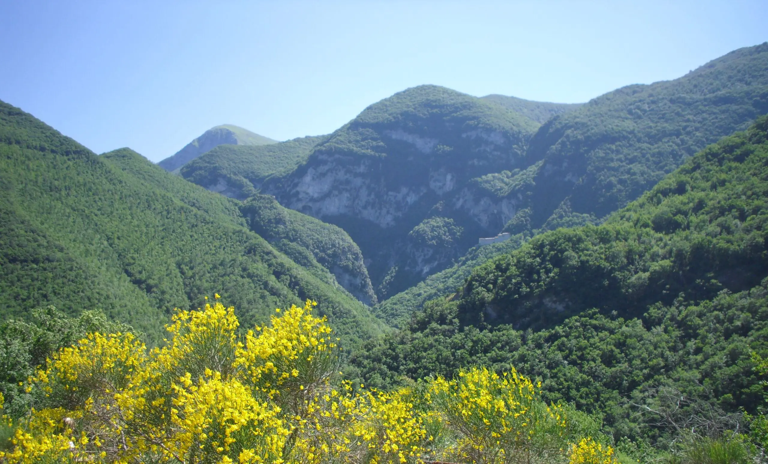
The third mountain area is perhaps the most spectacular of the three.
The Umbrian side of the Sibillini Mountains, around Castelluccio, Norcia and Preci, overlooks Piano Grande, the vast plateau that comes alive in early summer with the flowering of the lentil fields.
The National Park has developed a well-organised MTB network consisting of a 160-kilometre Great Mountain Bike Ring and more than ten day loops, according to the Park’s official mountain biking guide, “Il Parco in Mountain Bike”.
However, geography matters.
Most of these loops lie on the Marche side of the Park. On the Umbrian side, the most clearly documented route is the B11 “Piano di Santa Scolastica” loop between Preci and Norcia.
It covers 22.3 kilometres with 460 metres of elevation gain and is rated easy, making it suitable for e-MTBs as well, according to the official Park guide.
Around Castelluccio, user-generated routes provide additional options.
On Komoot, the circular route through the Sibillini Mountains and Piano Grande covers 31.8 kilometres with 840 metres of elevation gain and is rated moderate.
The flowering loop, meanwhile, covers just 12.6 kilometres with around 200 metres of elevation gain and is suitable for almost everyone.
Cycling at an altitude of 1,300 metres surrounded by flowering lentil fields is an experience worth the journey in itself.
What is allowed, and what is not inside the parks
Mountain biking is not unrestricted inside Umbria’s protected areas.
Cyclists must remain on the official hiking trail network, forestry and pastoral roads, and recognised tracks rather than riding off trail.
The Monte Subasio regulations state this clearly, while the broader regional framework confirms the same principle throughout protected areas: mountain bikes are permitted on trails included within the regional network and along specifically identified routes.
In practical terms: download the GPS track, stay on the marked trail and always give way to hikers.
When to go and how to move between the three areas
La stagione ideale per la MTB in quota umbra è doppia, primavera e autunno, quando il terreno è asciutto e le temperature tengono. Castelluccio dà il meglio tra fine giugno e inizio luglio con la fioritura, mentre in piena estate meglio salire di quota o partire all’alba per sfuggire al caldo delle valli. Le tre montagne non sono vicinissime tra loro. Il Cucco a nord-est, il Subasio nel mezzo, i Sibillini a sud-est. Ognuna merita almeno una giornata piena, e l’ideale è usarle come basi a rotazione, dormendo ai piedi di ciascuna.
Una raccomandazione vale per tutte e tre: qui si pedala in alta montagna, spesso lontano dai centri abitati e con copertura telefonica a tratti. Parti con acqua a sufficienza, un kit di riparazione e una camera d’aria di scorta, controlla il meteo prima di salire in quota e porta una giacca antivento anche d’estate, perché sui crinali dei Sibillini la temperatura cambia in fretta. La montagna ripaga chi la rispetta e non improvvisa.
Sulle salite lunghe, dove un anello del Subasio ti mette in conto oltre mille metri di dislivello, la e-MTB cambia le carte in tavola e apre questi percorsi anche a chi non ha gambe da agonista. La trovi nel nostro noleggio di mountain bike ed e-bike, con mezzi adatti al fondo tecnico di queste montagne.
Come organizzare il tuo viaggio MTB in Umbria
The best seasons for high-altitude mountain biking in Umbria are spring and autumn, when the terrain is generally dry and temperatures are comfortable.
Castelluccio is at its most spectacular between late June and early July during the flowering season, while in the height of summer it is better to climb to higher elevations or start at dawn to avoid the heat of the valleys.
The three mountain areas are not particularly close to one another.
Monte Cucco lies to the north-east, Subasio in the centre, and the Sibillini Mountains to the south-east.
Each deserves at least one full day, and the ideal solution is to use them as separate bases, staying overnight near the foot of each mountain.
One recommendation applies to all three areas: this is high-mountain riding, often far from towns and with mobile phone coverage that may be unreliable.
Carry enough water, a repair kit and a spare inner tube. Check the weather before heading to higher elevations and bring a windproof jacket even in summer, because temperatures can change quickly along the Sibillini ridges.
The mountains reward those who respect them and do not improvise.
On long climbs, where a Subasio loop can involve more than one thousand metres of elevation gain, an e-MTB can completely change the experience and make these routes accessible even to riders without racing-level fitness.
You can find one through our mountain bike and e-bike rental service, with bikes suitable for the technical terrain found on these mountains.
How to organise your MTB trip in Umbria
Travelling between Monte Cucco, Subasio and the Sibillini Mountains with your own bike is certainly possible, but relying on someone who knows the territory can make the logistics much easier.
Through our rental partners, you can find mountain bikes and e-MTBs in convenient locations, together with advice on which trails are most appropriate for your riding level.
Some of our cycling holidays already include off-road sections, and we can also create a customised mountain biking itinerary on request.
Contact us and we can build it together, including luggage transfers and assistance.
For accommodation near the trailheads, we work with a network of cyclist-friendly properties offering secure bike storage and e-MTB charging facilities.
If, rather than technical single track, you are looking for white roads and mixed terrain, read our dedicated article on gravel cycling in Umbria.
For a broader overview of cycling throughout the region, start with our guide to cycling tourism in Umbria.
And during the warmer months, discover the coolest cycling routes in Umbria, where you can ride in the shade.
Frequently asked questions about mountain biking in Umbria
Do I need a technical mountain bike, or is a hardtail enough?
It depends on the mountain.
For the easier loops on Monte Subasio and around Castelluccio, a well-equipped hardtail with suitable tyres is enough.
On Monte Cucco’s single tracks and the more technical downhill sections of Subasio, a full-suspension bike — or at least a hardtail with good fork travel — gives you more confidence and safety.
Always check the CAI classification of the route before setting off.
Which mountain is best for beginners?
Monte Subasio.
It is the best-documented of the three, offers official itineraries graded from easy upwards, and is just outside Assisi, making logistics and accommodation particularly convenient.
From there, as your fitness and technical ability improve, you can progress to Monte Cucco and the Sibillini Mountains.
What does a “BC” or “OC” trail mean?
They are two levels in the CAI mountain biking difficulty scale.
BC, meaning “good technical ability”, indicates very uneven dirt tracks and mule tracks with some obstacles.
OC, meaning “excellent technical ability”, refers to highly irregular terrain requiring strong technical riding skills.
Above OC there is only EC, the highest level, which includes trial-style technical passages.
Can these routes be ridden on an e-MTB?
Yes, and pedal assistance makes these mountains accessible to a much wider range of riders.
The Umbrian loop in the Sibillini Mountains is explicitly indicated as suitable for e-bikes, while on the long climbs of Subasio and Monte Cucco an e-MTB turns one thousand metres of elevation gain from a test of strength into a much more enjoyable ride.
Many of our partners offer e-MTB rental.
Can I ride anywhere inside the parks?
No.
In Umbria’s parks, bicycles are permitted only on recognised trails, forestry and pastoral roads, and official routes — not off the marked tracks.
Stay on the designated trail, respect hikers and do not create your own shortcuts. Following these rules helps ensure that these trails remain accessible to mountain bikes.
Sources cited
- Regione Umbria, Parchi in Umbria, www.regione.umbria.it/parchi-in-umbria
- CAI, Scala delle difficoltà per il cicloescursionismo in MTB, archivio.cai.it/wp-content/uploads/2023/05/Scala-difficolta-MTB.pdf
- Parco Regionale del Monte Subasio, Piano del Parco (access regulations), www.parks.it/parco.monte.subasio/pdf/PianoParco.pdf
- Parco Regionale del Monte Subasio, Official Cycling Routes, www.parks.it/parco.monte.subasio/Eiti.php
- Komoot, Routes around Monte Subasio Regional Park, www.komoot.com/it-it/guide/502014/fantastici-percorsi-e-itinerari-mtb-nei-dintorni-del-parco-del-monte-subasio
- Wikiloc, MTB Giro del Subasio, it.wikiloc.com/percorsi-mountain-bike/mtb-giro-del-subasio-2565067
- Parco del Monte Cucco, Sport and Hiking, www.parcodelmontecucco.it/it/itinerari/sport-e-escursionismo
- Komoot, MTB Trails around Costacciaro (Monte Cucco), www.komoot.com/guide/646174/mtb-trails-around-costacciaro
- Wikiloc, Monte Cucco’s Way, it.wikiloc.com/percorsi-mountain-bike/monte-cuccos-way-17994812
- Parco Nazionale dei Monti Sibillini, Il Parco in Mountain Bike, www.sibillini.net/en/comunicazione/download/ilParcoInMountainBike.pdf
- Komoot, Great Sibillini Mountain Ring (Umbrian side, Castelluccio/Norcia), www.komoot.com/collection/1679905/a-journey-through-nature-and-legend-great-sibillini-mountain-ring
Lorem ipsum dolor sit amet, consectetur adipiscing elit. Ut elit tellus, luctus nec ullamcorper mattis, pulvinar dapibus leo.